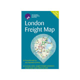
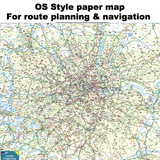
The folded London Freight Map ideal for drivers to route plan and to get the bigger picture of navigating across London. With hardcover for ease of use.
The map includes:
- Borough Boundaries
- The defined boundaries of the London Lorry Control Scheme (LLCS)
- The routing options for weekend and nighttime restrictions of LLCS
- All excluded (unrestricted) roads clearly marked
- Navigation aids that include:
- Tube and rail stations.
- Industrial estates
- Parks and key landmarks
- All the height, weight and width restrictions clearly marked.
- Bridge strike (top 10)
- LEZ (Low Emission Zone)
A quality product created by The Pie Guide in cooperation with TfL, London Councils and the London Local Authorities.


